government · England (national scale)
National Land Data Architecture for England
Flagship ProgrammeConceptual, logical and physical data architecture for national land data in England, unifying 15+ siloed systems across six arm's-length bodies and the core department — with operational storage and serving cost each cut by roughly an order of magnitude, at no loss of resolution or interoperability.
The Challenge
The Problem We Were Asked to Solve
Land data for England sat in more than fifteen separate systems, held across six arm's-length bodies and the core department. Each used its own classification schemes, attribute names and coordinate reference systems, with no common way to discover what existed.
The programme needed one authoritative model that could carry all of it: a shared spatial framework, reconciled taxonomies, and metadata consistent enough that land data could be found across organisational boundaries rather than within one.
Project Details
- Client
- UK central government department
- Year
- 2026
- Location
- England (national scale)
- Sector
- government
Tags
Our Approach
What We Built
Data Architecture
Designed the full model stack — Conceptual, Logical and Physical — covering cross-agency integration, attribute specifications and tiered storage. The Conceptual and Logical models were written to the department's data modelling standards and carried through its architecture review.
Metadata & Taxonomy
Designed the UK GEMINI 2.3 land profile, mapping the programme's metadata requirements to verified coverage, with a FAIR-aligned quality scoring framework. Harmonised source categories into shared code lists through a four-phase taxonomy workflow, reconciling habitat, land-parcel and soils classifications that had developed independently.
Physical Model & Serving Architecture
Benchmarked five storage designs in a Dockerised PostGIS simulation at national scale before build, then designed the physical implementation on a cloud data-engineering stack — distributed processing for national-scale ETL, cloud-optimised columnar formats at rest, and vector tiles served through open geospatial APIs.
The Results
What Changed
Architecture Impact - An open-standards serving architecture that cut serving cost by roughly an order of magnitude, with no loss of resolution or interoperability and no vendor lock-in - Operational storage cut from multi-terabyte to sub-terabyte, roughly an order of magnitude - Land data made discoverable across agencies through one shared metadata profile - Taxonomies reconciled across six arm's-length bodies into a single auditable classification framework - Storage designs evidenced by simulation before any build commitment
Technical Outputs - Conceptual and Logical data models, fully specified to the department's data modelling standards - UK GEMINI 2.3 land profile, ready for adoption across agencies - A taxonomy discovery pipeline in Python, documented and handover-ready - A tiered physical architecture specification for Hot/Cold/Archive storage
Work Examples
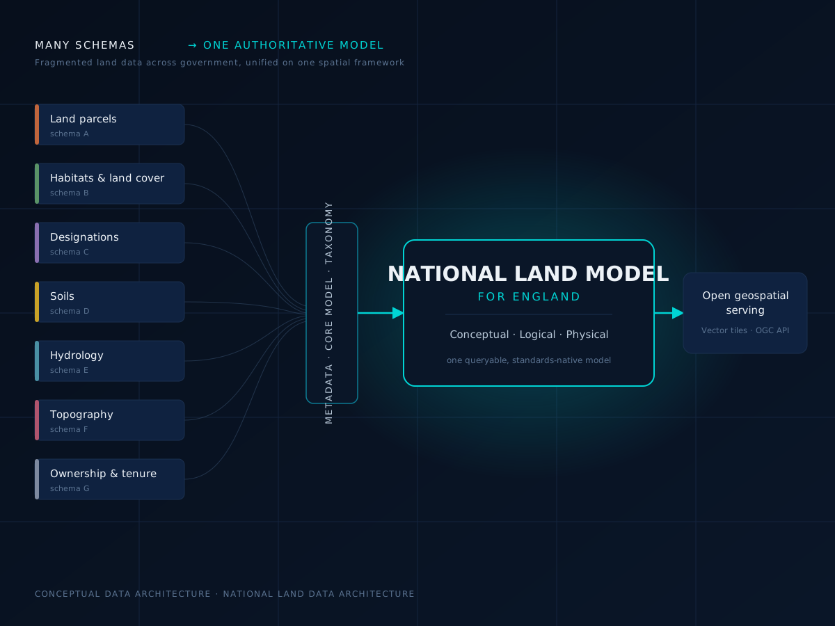
Conceptual architecture — fragmented land schemas reconciled, via shared metadata, a core model and taxonomy, into one queryable national Land Model.
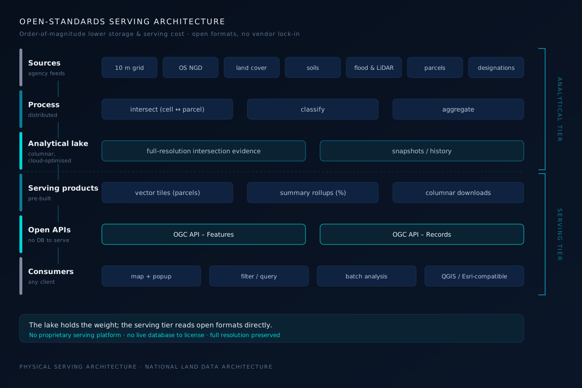
Physical serving architecture — the analytical tier holds full-resolution evidence; the serving tier reads open formats directly.
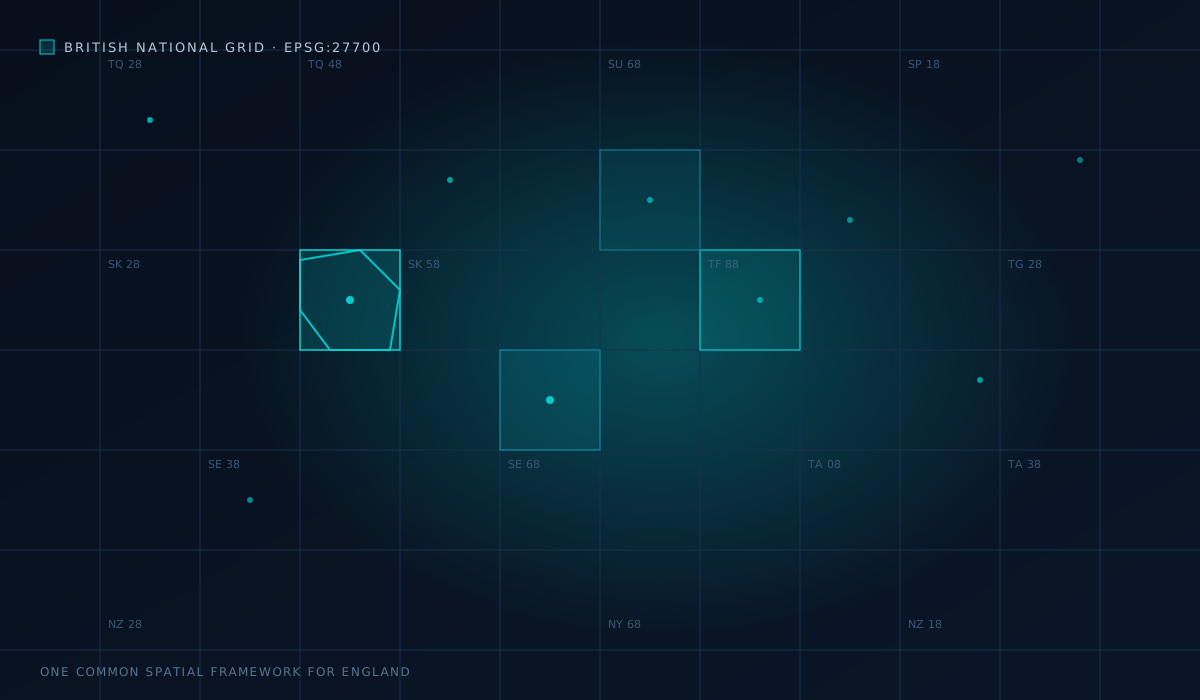
One common spatial framework — every source aligned to British National Grid (EPSG:27700) for consistent, cross-agency analysis.
Explore More